Paleomagnetism with Google Earth
Paleomagnetism is a discipline to research
the state of geomagnetic field at a time past.
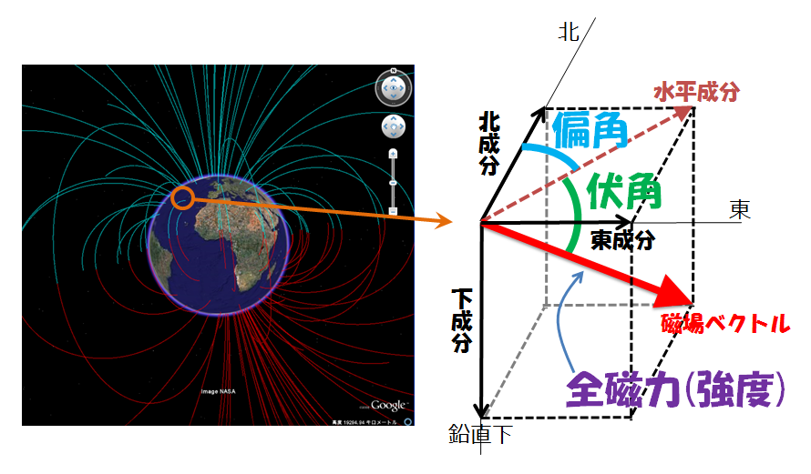
An ideal goal of each measurement is to obtain the orthogonal or the polar coorinate three components (
Bx, By, Bz or Inclination, Declination, Intensity).

However, in many real measurements in paleomagnetism, measurement of field intensity is much difficult than that of direction data (inclination and/or declination) because of technical and sample reasons. Therefore only direction data are solely measured in many paleomagnetic studies.
In the case of measurement of three components, we can plot the magnetic field in 3D coodinate. On the other hand, measurement of directions (I and D) restrects data plot on a unit (r=1) sphere. Actually we use projections on a plane (of paper) for exposition of the results of paleomagnetic studies.
Now we propose a new method to project the data on Google Earth instead of paper use.
Drastic Geodynamo << Paleomag with Google Earth >> Direction changes in Japan 2ky